
Sam Koshy was ambitious enough to write a Python script that will colorize the points in a KML file with respect to altitude as shown here: If you’re interested in having your data color coded like this, you can follow these simple steps: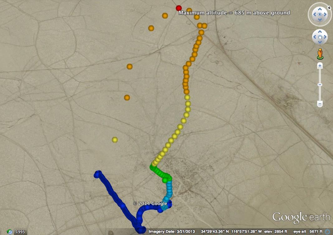
- Download and unzip the python script that Sam wrote: http://s4.sonoma.edu/wp-content/uploads/2014/07/Colorpy.zip
- Use the S4 Data Manager to export your desired data set to a KML file as normal
- Make sure that the python script (Colorpy.py that you extracted in step 1) and the file you want to edit are located in the same folder on your computer.
- Open the Colorpy.py in any text editor
- Locate the line in the file that reads xmldoc = minidom.parse(“MoffettLaunch.kml”)and change the text inside the quotation marks to match the file you want to colorize: xmldoc = minidom.parse(“MyFileName.kml”) Save the file
- Execute the python script, and it will create a new file called “fileout.kml” that has the colorized data set.
Executing a python file requires you to have python installed. You should have no trouble finding a tutorial on running a python script on your particular operating system if you Google it, but if there is sufficient interest in this process, I will be happy to write a quick tutorial.